Category: Length

Deadman’s Hole loop
A short loop to the south east of Bruton featuring views of Alfred’s Tower and Glastonbury Tor. The route is generally easy underfoot, but some electric fences, locked gates and poor stiles make it tough going for the less agile and upgrade it to moderate. Around 3 miles, moderate.
Read More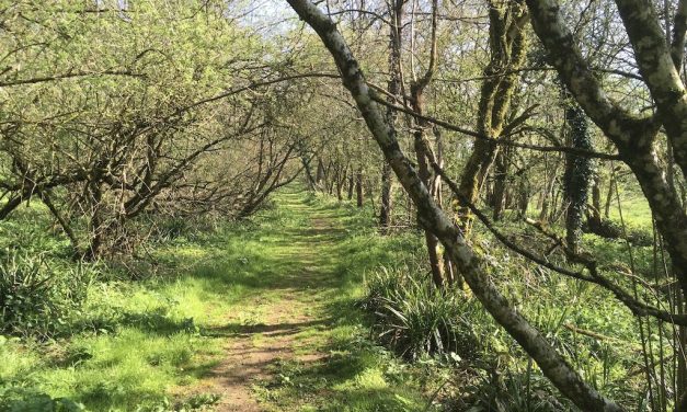
Batcombe: the long way round
This new walk is the longest walk on the site, using less well-known routes to visit Batcombe and return via Milton Clevedon and Lamyatt. The possibility of seeing hare and deer, the certainty of good views and a pub just before the halfway mark make this a good day out. Because of its length this cannot be considered a beginner’s walk. 9 miles (14.5km), 3 hours 30 minutes to 4 hours 15 minutes, moderate.
Read More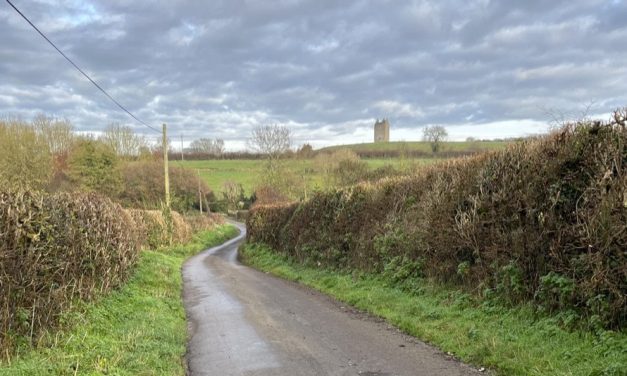
Lusty Hill and New Barn Farm
This short and easy walk takes you up Lusty Hill Lane, across fields and back via Godminster Lane. Pleasantly quiet and rural, but undemanding. 2.5 miles (4 km), 55 minutes to one hour 15 minutes, easy.
Read More

Godminster, Pitcombe and Cole
This walk ambles ambles through rural landscapes to the south of Bruton, visiting pretty Pitcombe Church. Cows, sheep and a couple of tricky stiles make this a moderate but not a challenging walk. 5 miles (8 km), two to two and a half hours.
Read More
Creech Hill from the east
From the southern flank of Creech Hill, the view extends from Alfred’s Tower in Wiltshire to the east and Cranborne Chase in Dorset to the south, to the Brendon Hills and Devon border 40 miles west. Much of Somerset is visible in between. This new walk takes full advantage of the view but avoids the steep climbs of most routes up the Hill. 6 miles, 9.5 km, two hours 20 minutes to three hours, moderate.
Read More
Cole (Set 2 No 8)
This shorter walk visits the pretty hamlet of Cole, and returns through lovely countryside along the River Brue, on footpaths and quiet roads. 3 miles (5 km), 70 to 90 minutes, easy apart from one short section.
Read More
Batcombe and its Bottom
This longer walk visits Batcombe Bottom and Batcombe itself, before returning via Moor Lane and Henley Grove Farm. From September 2022 the Three Horshoes should reopen as a pleasant stop-off. Some great views and deeply rural countryside.
Read More
Ansford and Cole (set 2 no 1)
This longer walk visits the hamlets of Wyke, the edge of Ansford, and returns via Cole with splendid views off Ridge Hill. Combines well with lunch in Castle Cary 7 miles, 2 hours 35 minutes to 3 hours 20 minutes, moderate, with some mud and steep sections.
Read More
Creech hill via Brickhill and Huish Lane (Set 1 No 3)
This excellent medium-length walk brings very varied scenery, the best view of Bruton, and great views from near the top of Creech Hill. 5 miles (8 km), 2 hours to 2 hours 25 mins, moderate.
Read More
Godminster (set 1 no 9)
A short stroll up the gentler hills to the south of the town, with views of Glastonbury Tor and the town. 2.5 miles (4.2 km), 55 mins to 1 hour 15 mins, easy.
Read More
Hadspen (set 1 no 5)
This longer walk (an update of Walks Around Bruton series 1 no. 5) visits the hamlets of Wyke Champflower, Hadspen and Pitcombe. Great views, a varied landscape, and quite a few ups and downs. Expect mud in winter, and cattle in summer. 7 miles (11 km), 2 hrs 25 mins to 3 hours 15 mins. Moderate.
Read More
Lamyatt (set 1 no. 4)
This medium length walk visits the attractive hamlet of Lamyatt and its Church and returns via the crest of Creech Hill and Greenscombe. One very steep descent, and parts can be very muddy in wet weather. 5 miles (8 km), 225 m of ascent. Two hours to two hours 30 minutes. Moderate.
Read More
Mill Dam (Set 1 no. 10)
A short walk around and just outside the town, with some good views. 2 miles (3.4 km), easy.
Read More


Wyke and Huish Lane
Follows the old Trendle and Huish Lanes out of and back into Bruton. Excellent views. Can be extremely muddy in wet weather. 3.75 miles / 6 km, 85 to 110 minutes, easy.
Read More
Cole, Honeywick and Wyke (mud-free)
A long walk for days when the winter mud gets too much! Entirely on minor roads, this is an easy walk, visiting some lovely hamlets and with splendid views. Combines well with an outing to Castle Cary. 7 miles / 11 km, 2hrs 15 mins to 3 hrs.
Read More
Northern and southern views of Bruton
A short walk in and outside the town, to the hills immediately to the north and south with views back over the town. Easy, 2miles / 3.5 km, 50 to 65 minutes.
Read More
Cole, Hadspen and Pitcombe
This longer walk visits three of the attractive hamlets to the south west of Bruton as well as Pitcombe Church. Moderate, 6 miles / 10 km, 2 hrs 15 mins to 3 hrs.
Read MoreBatcombe to Spargrove and back
As of April 2026 part of this walk has been closed by Somerset Council, with no alternative route recommended.For further details see here. The walk from Batcombe to Spargrove is delightful, well-signed, and very easy to follow...
Read More
Beware Rabbits and Greenscombe
Now stile-free, this medium-length walk explores the deep coombes north of Bruton. It includes some excellent views and visits the oldest oak in the entire area. Easy but with some steep sections. 5.5 miles / 9 km, 120 to 150 minutes.
Read MoreBruton to Batcombe via Moor Lane (route D)
Starting at Bruton Community Office Walk west along the High Street (against the traffic) and take the first right turn up steep and narrow St Catherines Hill. The road levels and crosses a junction into Higher Tolbury. Continue...
Read MoreBruton to Spargrove via Lamyatt (route C)
Starting at Bruton Community Office Walk west along the High Street (against the traffic) and take the first right turn up steep and narrow St Catherines Hill. Ignore a turning to the right opposite the Scout Hut. At the next...
Read MoreBruton to Spargrove via Greenscombe (route B)
Starting at Bruton Community Office Walk west along the High Street (against the traffic) and take the first right turn up steep and narrow St Catherines Hill. The road levels and crosses a junction into Higher Tolbury. Continue...
Read MoreBruton to Batcombe via Hedgestocks (route A)
Starting at Bruton Community Office Walk west along the High Street (against the traffic) and take the first right turn up steep and narrow St Catherines Hill. The road levels and crosses a junction into Higher Tolbury. Continue...
Read More
Batcombe and Spargrove Pick-and-mix
A choice of routes to beautiful Batcombe Vale and back. Medium-long to long depending on the route chosen (5.5 miles / 9 km to 8.5 miles / 14 km).
Read More
Wyke Circuit via Gants Mill and Ridge Hill
A glorious medium-long walk through a range of different landscapes with excellent views. Mostly on easy footpaths or very quiet country lanes. 5.5 miles / 9 km, 120 to 150 minutes.
Read More
Marydown & Bruton Dam
A popular local circuit. Apart from the beginning and end it is all off-road, on paths and tracks, with good views of gentle rolling countryside and a pleasant meadow section by the River Brue. Easy, 3 miles / 5 km, 70 to 90 minutes.
Read More